Water Balance

Speichern, ausfüllen, drucken, fertig!
How to create a Water Balance memorandum? Download this Water Balance report template now for your own benefit!
Verfügbare Gratis-Dateiformate:
.pdf- Dieses Dokument wurde von einem Professional zertifiziert
- 100% anpassbar
Business Unternehmen Real estate Grundeigentum model Modell help Hilfe letters briefe Water Wasser Letterhead Briefkopf Army Letterhead Briefkopf der Armee
How to create a Water Balance memorandum?
The provided text describes a memorandum prepared for CELRE (likely the U.S. Army Corps of Engineers, Detroit District) in response to a request under the Dredging Operations Technical Support (DOTS) program, specifically request 2006-001. The objectives of the memorandum were to:
Estimate Annual Average Drainage to the Overflow Weir Due to Runoff:
This involves calculating the amount of water that flows over the weir annually as a result of runoff from precipitation and other sources.
Estimate Annual Average Seepage Through the Dike Walls:
This involves determining the amount of water that seeps through the dike walls on an annual basis.
To achieve these objectives, the memorandum utilized a water balance model, specifically the U.S. Environmental Protection Agency’s (USEPA) Hydrologic Evaluation of Landfill Performance (HELP) model. The HELP model is designed to simulate the hydrologic processes of landfills and can be adapted for other uses, such as assessing drainage and seepage in containment structures like dikes.
The memorandum also involved reviewing studies cited by Millsap (2004) to gather necessary hydrologic data, such as water table elevations, which were used as inputs for the HELP model.
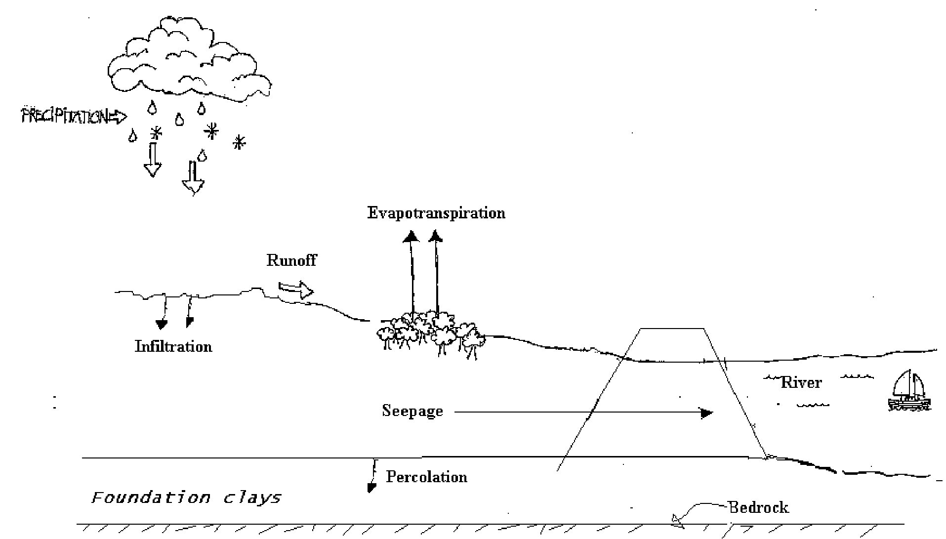
The second part of the text explains the concept of a water balance, which is the process of accounting for the input, output, and changes in storage of water at a given location, such as an agricultural field, watershed, or continent. The water balance helps in understanding the hydrologic conditions and managing water resources effectively.
A figure (Figure 1) mentioned in the text would provide a visual representation or definition sketch of the water balance specifically for Grassy Island, illustrating how water inputs, outputs, and storage changes are considered in the water balance analysis.
Download this Water Balance report template now for your own benefit!
HAFTUNGSAUSSCHLUSS
Nichts auf dieser Website gilt als Rechtsberatung und kein Mandatsverhältnis wird hergestellt.
Wenn Sie Fragen oder Anmerkungen haben, können Sie sie gerne unten veröffentlichen.
